Anticipation, Worry, Excitement
Four months of planning. Gear lists, Food, Medical Supplies, Maps and the utmost concern...weight.
No concerns about Daniel. He is in the top of shape both physically as well as cardiovascular. Timmy is a bit of an unknown but I am sure he will be fine. Myself, age, knees, fitness and above all, attitude must remain high. Hopefully the exercise routine will help and starting at 3000 ft will aid in the transition.
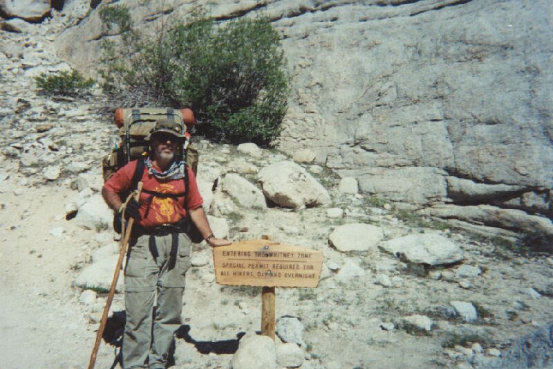
The drive to Whitsett was like a return to the past. Highway 14 has not changed in the 30+ years that have slipped by. Red Rock Canyon was beautiful as ever. Walker Pass and Kernville had grown but not much. Stopped by the Ranger Station at Kernville to check in and obtain fire permits. We had been in touch with the Rangers to obtain all the required Wilderness Permits over the phone and it was nice to meet the crew in person. For the conservation project it was asked that we pick up trash along the 100 mile of trail and to clean the fire pits of all garbage that was not able to burn. This we agreed to do and we pushed on towards Camp Whitsett, BSA where our adventure would begin.
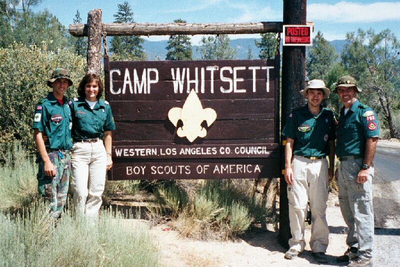
Camp Whitsett was like a return to the past. We were accepted and treated graciously. Mike, Base Camp Director, gave us complete access to camp. I visited the places that I had known well during my summer camp experiences in the 60’s and 70’s. I visited Omaha campground where my older brother and I spent many nights together with Troop 148. I went to the Waterfront where I spent the better part of three summers. Memories came back and it was great to show Daniel and Lea a place that meant so much to me during my early years.
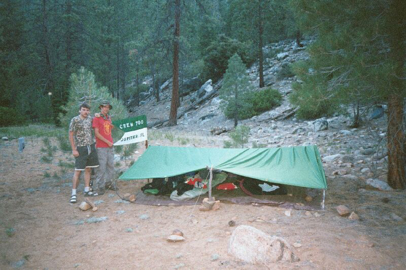
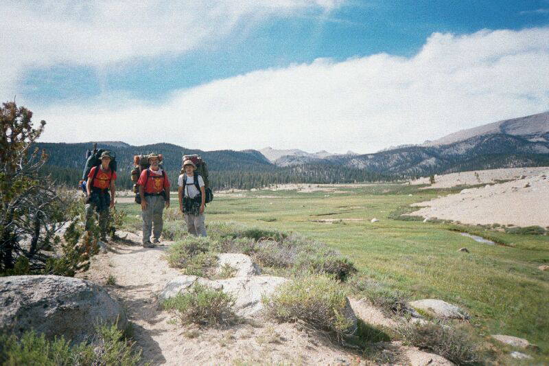
The camp Outpost Director pulled us to the side and let the Venturers crack the bullwhips and throw the tomahawks. We gave him a Gulf Stream Council patch for his courtesy and thanked him for showing us around but time was getting late and we had a long trail to cover. So, after saying thanks and getting some pictures we were off down the trail.
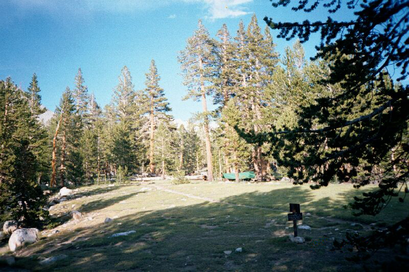
Day 1 - Sunday June 24, 2001 ~ Camp Whitsett to Little Kern
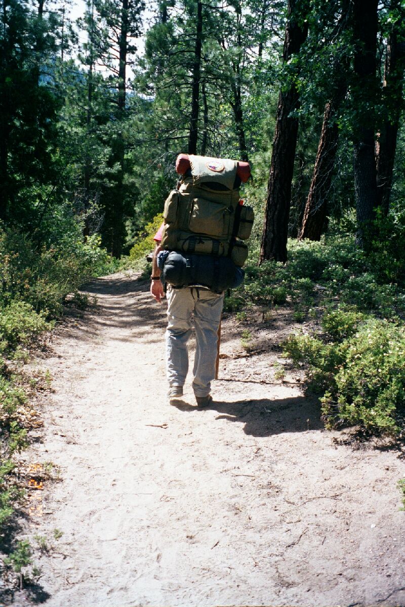
The first day we progressed well down the road to the Jerkey Meadow trailhead. Simple hike and we made better progress than expected. 18 miles of easy going which was uneventful. Excitement aided in making more progress than what was planned. However, it did prove that this was going to be a dry hike due to a very dry summer in the Sierras. We must plan water well and use ever opportunity to replenish our water supply.
 Upon arriving at the Jerky Meadow trailhead we knew that the hike was really going to begin. We began a steep trek up to Lloyd Meadows and back down to the Little Kern River. A total climb of 2,000 ft and right back down the other side losing about 1,500 ft of the climb. The climb of 2,000 ft was covered in 2 miles, which was a test of what was to come. The worries returned. Daniel and Timmy led and were soon in front by ¼ mile. I lagged behind conserving and worrying. It was late in the day and very hot. Water was scarce. Daniel and Timmy would wait every ½ hour for me to catch up. However, half the way up the hill they tired and I caught up. Youthful energy was spent and it was now time to "trudge" up the hill with the old man. This energy depletion of the young men should have been noticed, as it will play a vital role in the mid to later portions of the trip. Timmy led with Daniel in the middle. I took the well-known and usual spot in the rear. Seemed like hours of huffing and puffing but we made it to the top and stopped for lunch.

I was worried a bit about Daniel. He was quiet and it looked like the hill had taken its toll. We started downhill. Different muscles and different pains. 2½ miles later and back to 5,600 ft and we were at camp. A beautiful spot overlooking the Little Kern River. Fire was made, cooking started, water was fetched from the river and we were back to normal. The food was hung from a boulder for fear of visiting bears. The fire was good and the stars were bright. In bed at 9:00 PM. A very cold night. Ice on the sleeping bags in the morning. I could not help to wonder how cold it would be at the top.
Day 2 - Monday June 25, 2001 ~ Little Kern to South Fork of the Kern
Up at 6:00 AM. This would follow a pattern over the next twelve days. Soreness and muscle cramps would not let me sleep deeply and the thought of bears in camp made sleeping light, when I could sleep. But, I made up for the lack of sleep on the trail. The Venturers were making fun that all I needed to do was stop and I was fast asleep. These were good rests that I needed very much.
I let the kids sleep this first morning. By the looks of the maps it was going to be an easy day. But I did not judge the trail well and things were about to get tough. Around 7:00 AM and old timer came walking through camp. He advised us to take a short cut that took us over the top of the hill. It was not in my plans but I thought that he would know better. His route would indeed cut 2 miles off the trip but my plans took us to the same spot with little elevation change.
Daniel and Timmy got up around 8:00 AM. We played and explored a bit then packed and went to the river to eat and pump water. It was 10:00 AM and we decided to do what the old timer had told us to do.
Well the climb was about 1,000 ft straight up the hill. In the heat of the day it made hiking miserable with our fully laden packs. It was very slow going and we finally crested the summit around 1:00 PM. Now we were exhausted and dehydrated. The next part of the trail was downhill, which was not easy. We made the junction of the original trail that we left when we decided to take the advised short cut. If we had continued as planned we probably would be at the same spot at the same time less exhausted. I made a pact that I would not deviate from the plans that we made so carefully again. Yes it did cut off 2 miles but our bodies paid for it.
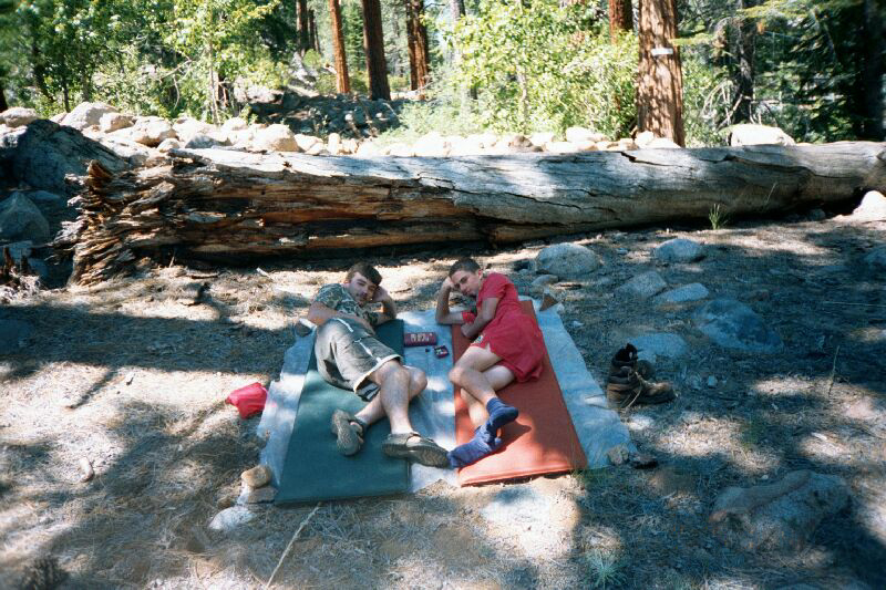
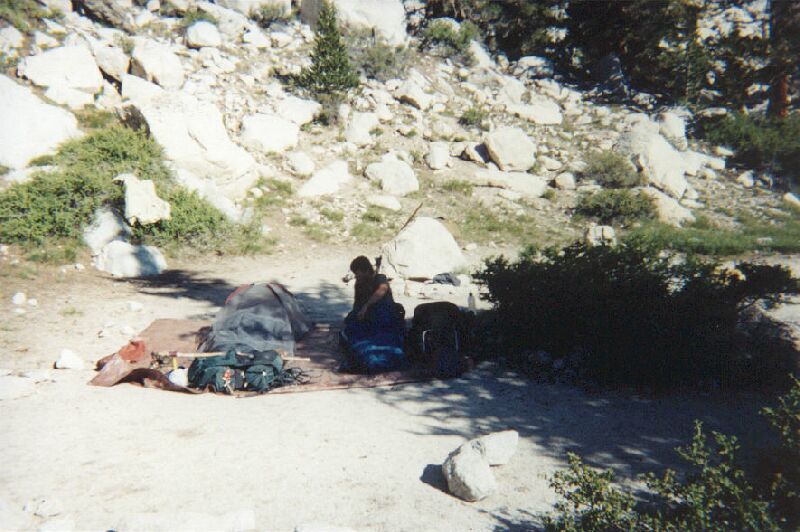
We decided to take a rest and cook lunch. It was now that I began to understand the importance of calories and the affect that calories had on the well being of the young men. The kids slept for about an hour and I used one of the backup meals to give them more energy. We were to push on to Grasshopper Flats, another 3 miles down the trail. The trail consisted of about a mile of a gradual uphill then steep downhill meeting the Kern River. We made the river and came to a beautiful camp. However, it was 1½ miles short of our destination, Grasshopper Flats. We met and discussed our options knowing that if we stayed, that tomorrow´s hike will be longer. We voted and the decision to stay was gladly accepted so we ate, got cleaned up and went to bed about 9:00 PM. The temperature was perfect.
Evenings were tough on me. Before I went to bed I questioned the fact whether we were going to make it. Depression and exhaustion were playing head games. I needed to stay positive and provide a model for the Venturers. They look to me during hard times. They do not need to see me questioning our ability.
Day 3 - Tuesday June 26, 2001 ~ Kern River to Kern Ranger Station
Woke at 6:00 AM feeling like new. A bit stiff but ready to push on. I always look forward to the third day on the trail. We are getting acclimated and the soreness is not so intense. It happens every 50 miler and it is happening now. Woke the kids at 7:00 AM. Pumped water, ate then back on the trail. Today we were going to walk the Kern River with two moderate climbs. One of about 500 ft the other about 250 ft. We made it to the first and over the top by 10:30 AM. Things were indeed going better. We began to appreciate the views and stopped to take many pictures. Little Kern Lake, Kern Lake, and then on to the Kern Ranger Station. A hard 5 miles but we arrived at 3:00 PM. We slept and cooked lunch.
Later in the day we went to find one of the location's soda springs. I was able to show Daniel and Timmy how to make carbonated cool aid. This they thought was interesting but they did not necessarily like the taste. It was just another "Sierra" experience.
We were a bit let down by the camp we had chosen. It was in the open and the wind was blowing pretty hard. This was to be a lay over spot and we had a discussion of not laying over the planned day. During our evening meeting I was reminded about changing our plans and what it did to us on day 2. I successfully lobbied that we needed to stay and rest. The next hike would be a climb of elevation of 3,000 ft in 6 miles. All switchbacks and no mercy. We decide to stay.

Daniel went fishing and was successful in bring trout for dinner. What a blessing. Things were looking up. However, I was having some problems with exhaustion and depression. I took it out on the kids by losing my temper over a simple thing like the amount of tin foil we were wasting. It was important at the time, but after a few Motrin, I realized that there was no need to blow such minor things out of proportion. I made a resolution to not let it happen again. A resolution that I kept till the last day of the hike.
We slept well in the shadow of a massive rock. 2,000 ft into the air the rock rose. It block the full moon till about 2:00 AM. That gave the kids time to count satellites and try to decide if they were Russian or American. Things were getting better.
Day 4 - Wednesday June 27, 2001 ~ Layover Day
Up again at 6:00 AM. Let the kids sleep. Daniel is sleeping a lot and is a bit blue. Probably missing home and friends. Timmy’s back is hurting and requires medication. This is a badly needed rest day. Daniel does not have the reserves that Timmy and I have. Daniel will run at full speed and then crash. I realize that I will need to feed the kids more often if we are to keep up the pace. I will also spread my food out amongst the both of them so they have more calories to burn. I have more than enough reserve fat and it will be good to lose a few pounds.
While the kids slept I went about a mile downstream to a pool to try my luck at fishing. I caught 5 large trout in a short time and was able to bring them back to camp. We will cook these for lunch and we must catch more for dinner. I plan on bringing the kids back this afternoon to try their luck.
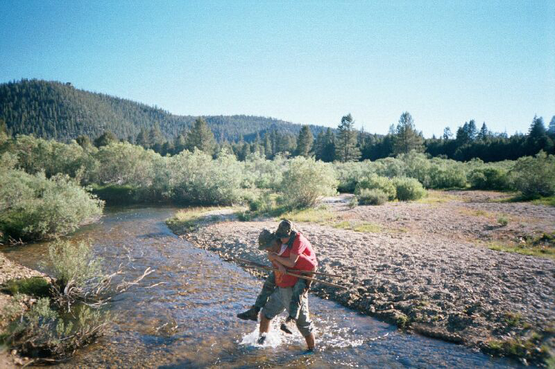
When I returned to camp the kids were asleep. I woke them about 9:30 AM and made breakfast. We took the time to set up camp by getting the fly out so that we could have some shade during the day. We decided to go check in with the Ranger and see if we could borrow the washtubs that we had seen while we walked by the day before. We met a trail crew and were informed that the Ranger was gone and not expected back till Thursday. He informed us that he could not give us approval to use the tubs so we went to the river to fetch water to clean our clothes. We also took the time to clean ourselves and go for a swim in the river. It was an extremely cold experience for us Floridians, but we were led by our Californian, Timmy, in getting into the frigid waters.
Fish lunch and a game of cards for the kids and a nap for me. It couldn't get any better. Planned on going fishing later in the evening for tonight’s meal.
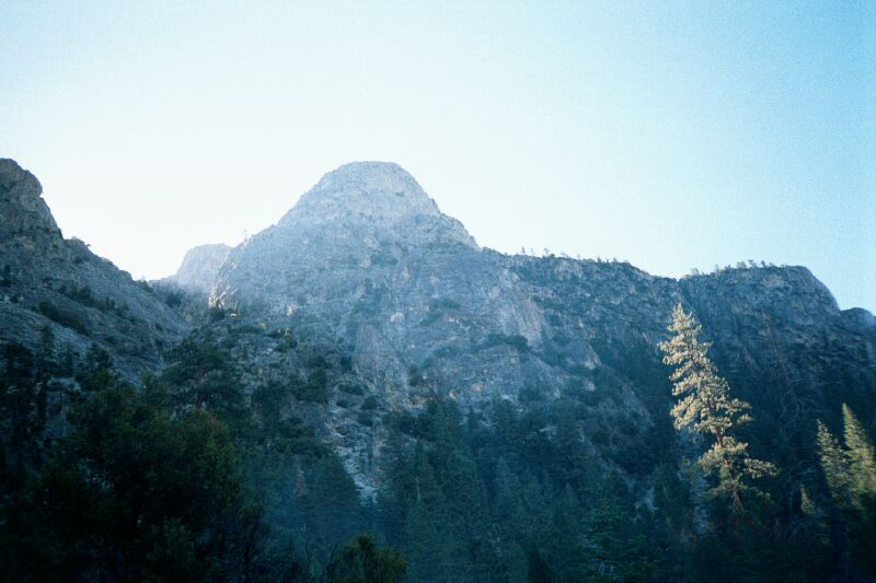
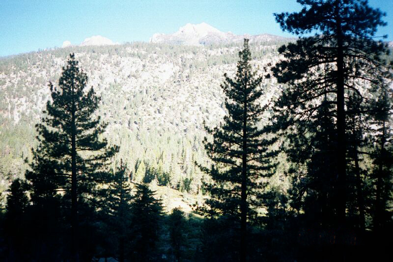
Saw another group of Backpackers make their way across the Kern River Bridge. They were going up the Golden Trout Stream trail. The same way that we were going to go the next day. Watching them go brought thought of what tomorrow had in store. The beginning of many difficult climbs climaxing on the top of Mt. Whitney. We were currently at about 7,000 ft above sea level. In 7 days we would be at 14,495 ft. We expected a very difficult day.
The afternoon brought more napping and later we returned to the pool to catch fish. Daniel with the fly rod and Timmy with the lures. Tim caught a couple of very nice fish as well as Daniel catching two fish on a dry fly. His first experience at fly-fishing. We are going to have an excellent dinner tonight.
At dinner we were finding that we are not eating as much, so some of the contents are not being consumed. We spoke of this and decided to keep all food and eat the next morning for breakfast. This was gladly accepted by all of us and proved to be a good decision for the rest of the trip. We were able to eat in the morning and have breakfast on the trail around 10:00 AM. We began to understand that we must eat numerous times during the day to have enough energy to make that days hike. Both Timmy and Daniel do not have my reserves and burnout rather fast. My lunches are now going entirely to the kids and it is helping keeping them going.
The second night was as beautiful as the first. This is a great spot and I will need to return some day.
Day 5 - Thursday June 28, 2001 ~ Kern Ranger Station to Tunnel Meadow
The infamous 5th day. The day that we dreaded and anticipated. Up 2,500 ft in 5 miles. Unfortunately, 1,500 ft was in the first 1½ miles. The rest a gradual incline ending at Little Whitney Meadow.

The first part of the hike was flat. About a quarter of a mile along the river through the sagebrush. Then the switchbacks started. The kids went faster so I ask them to stop every mile to wait for me. They stopped numerous times to let me catch up. This made me feel good that I could keep up with them when the going got rough.
To all our surprise, this hike was not too difficult. We were slow but we started at 7:00 AM. We must be coming acclimated. Coming up the hill we could see what lay before us. Bald mountains above treeline. I kept pointing out the highest mountain all the while reminding the kids that we would go higher. We crossed a place where the Golden Trout Stream crossed under a natural land bridge. The trail just went over the bridge and continued up the mountain.
We came to the end of the hike at Little Whitney Meadow at around 12:00 PM. We stopped ate lunch and napped. The kids played chess while I slept. While we rested the mosquitoes invaded us. There were a lot of the horrible insects. I made a lunch of mash potatoes and turkey salami. It is amazing what one will eat while on the trail. It was good and not a morsel was left.
After lunch the kids wanted to continue to Tunnel Meadow. This was a relative short and easy hike and we discussed the need to get away from the mosquitoes. We all agreed which turned out to be an ominous decision. We were at 8,000 ft now with a 3½ mile hike to go. The hike will be easy and flat but it will take its toll on Daniel, Timmy and myself.

The hike was flat and followed the Golden Trout Creek. It is a pleasant place to idle along. The stream is crystal clear and loaded with numerous golden trout. I would stop to watch the fish strike at everything that hit the water. The pools were beautiful and the afternoon went by fast.
At approximately 2½ miles into the hike Daniel ran out of energy. He ran up against the wall and did not have the reserves. He was spiraling downward fast suffering from what I surmised as altitude sickness. We made it to the intersection of the trail and the Golden Trout Stream and we hurriedly set up camp. We quickly ate dinner. Timmy’s back hurt so badly that he had to again take pain medication. Daniel was sick to his stomach and could not eat. He went to bed around 8:00 PM. Timmy and I stood around the fire while worry set in.
What about altitude sickness? What if we could not go on? I spent most of the evening and the rest of the morning trying to find the closest exit point to use in an emergency in case we could not go on. In the middle of the night I came down with a migraine headache and was close to being sick myself. I will fight this headache for the next day. Fear set in. It was 25 miles to the closest exit point at Cottonwood Creek. However we would have to go over a 12,000 ft pass to get there. Exhaustion brought back the questioning and uncertainty.
Day 6 - Friday June 29, 2001 ~ Tunnel Meadow to Big Whitney Meadow

The next morning was a gift from God. Daniel slept for 13 hours and was feeling great. Timmy was better and my headache lessened. We ate last night’s dinner and had another meeting. I pointed out all the exit points that I had found on the maps the previous night. We discussed emergency issues and reviewed some first aid techniques. It was all up from here. We were to leave this area and walk to the headwaters of the Golden Trout Creek today and up and over Siberian Pass at 11,500 ft tomorrow. The decision to push on was an easy one due to the fact that we all were feeling better. We decided to push on and take many rests during today’s hike.

We started the trail passing the Tunnel Guard Station. It had completely burned down a few years earlier but the corrals were still there. The "Tunnel" at this place was built many years ago that diverted water from the Golden Trout Creek to the South Fork of the Kern River. I would imagine that water was needed to aid in the search for Gold many years ago. This is the location that we left the main trail to follow the Golden Trout Creek to Big Whitney Meadows.
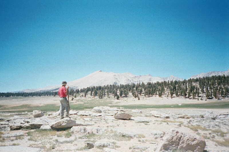
Today was to be a 5 mile hike gaining 1,000 ft along the way. By passing Little Whiney Meadow we were now one day ahead of schedule. And we could take shorter hikes if needed or even take a second Layover day. The hike up the creek was excellent. The climb was gradual and it seems as though we are getting our high altitude "wind". We followed closely to the creek and again saw many trout in the pools. At around 3:00 PM we came to the beginning of the Big Whitney Meadow. A fantastically beautiful place about one mile across and two miles long. This meadow is right at timberline, 10,000 ft above sea level and gave us a view of tomorrow’s hike over Siberian Pass. We progress to the upper sections of the Meadow and made camp for the evening.
No fires above 9,600 ft in this area. We know had to rely on using the stove for cooking. The stove had been giving us problems. It was leaking but I seem to get it sealed before each time we used it. We will need the stove everyday till the end of the trip. Without it, we will be in trouble.
Mexican Casserole on the menu tonight. Plan to get into bed early. The Mosquitoes are 10 times worse than at Little Whitney Meadow but only came out around 7:00 PM at night and left at dark. During the mosquito "flight", all we could do is "hole" up in our shelters until they went away. I had a full mosquito shelter with me and Daniel had a simple canopy. Timmy had nothing so Daniel crawled in with me and gave Timmy his canopy. This was time for rest waiting for the sun to go down. I was a great day!

After dark we finished dinner. It was getting extremely cold. We went to bed early. Both kids were going to have difficulty with the cold in the meadow. We studied microclimates before leaving and we were now going to experience the results of not following simple rules. It was to get well below freezing where we had set up camp during the night. We wore all clothes that we brought while in our sleeping bags. What a beautiful night though. We had sky on all sides. We were at 10,000 ft and going higher tomorrow.
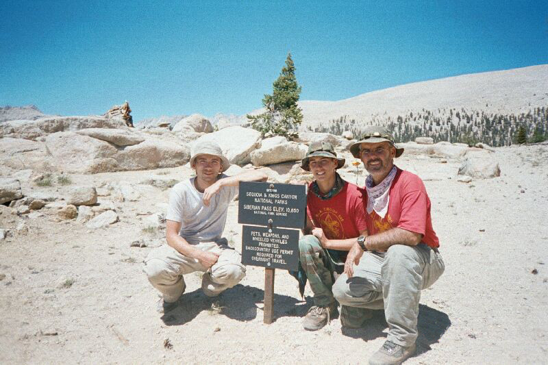
Day 7 - Saturday June 30, 2001 ~ Big Whitney Meadow to Siberian Pass
Upon waking in the morning ice was on everything which was to delay our early departure by a few hours. If we would have set up camp a few hundred feet away along the timberline and rocks, the temperature would have been many degrees warmer. This was a valuable lesson for future camps. However, we were to go higher so we will need to acclimate.

Morning comes early here in the heights. I was up at 4:30 AM and I woke the kids at 5:45 AM. We decided to hold off breakfast till the base of the Siberian climb. We set equipment out to thaw and dry. We wished the mosquitoes away. We were to need all the energy stores that we had to make this difficult climb at high altitude so delaying breakfast was a wise decision.
We walked from the meadow and got to dryer spots on the trail. It has been a very dry year in the Sierras and today’s hike will be dry. We filled every canteen and bottle with water from Big Whitney Meadow. It became obvious that it would not be enough.
We came to a spot and ate breakfast. Daniel decided that he was going to use the GPS to locate a spring that was on the map half way up the hill to see if there was going to be water flowing. Daniel is a master with a compass and GPS so we all agreed and the young men began the push up the hill. I followed at a much slower pace. The Venturers would leave their packs on the trail when they would go looking for the spring.
The climb was not as difficult as we thought. We all arrived at the spot where we were to look for the spring. We dropped our packs and followed Daniel’s lead to look for the "lost" spring. To our surprise, Daniel and the GPS led us right to a small meadow with a small pond. Water was flowing from the low spot and it was crystal clear. We used the pumps and filled our bottles with cool water. We will now be OK till Rock Creek, 11 miles away.
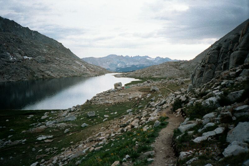
The last part of the climb over Siberian Pass was difficult but OK for us physically. When we crested the trail the most magnificent view lay before us. We were now at 11,500 ft above sea level, which is above timberline. Siberian Outpost lay before us. A stark meadow that ran in a westerly direction for miles, nothing but rock and meadow and many of the furry creatures that are called marmots. Marmots look somewhat like a cross between a beaver and a groundhog. These creatures will be present for the rest of the trip and will prove to be a bit of a nuisance. The view was so magnificent that it brought tears to my eyes. One cannot put into words the beauty of this scene. This was not a planned stopping place but I decided to ask the others if we could lay over in this spot for the afternoon and leave in the morning. We were ahead of schedule by one day. After our short meeting the decision was made that we would indeed stay for the night. I was delighted. I spent the rest of the afternoon wandering about the place by myself pondering life here as well as beyond the mountains. The boys were gracious to leave me alone with my thoughts while they amused themselves by playing chess and cards.
I explored the meadow where I found the places that marmots live. I moved to the ridgeline to where the pass looks back down 5,000 ft from where we came over the past 4 days. It was at this place where a strange phenomenon took place. The air was still till I approached to within a few yards of the ridgeline. It was here that one was hit by 40 mile an hour winds coming up from the canyons below. If one step back a few yards, the wind would disappear. I went to get the boys to show them this natural event and we all were amazed by nature’s power. These diverse events are compounded at such altitudes.
Around 6:00 PM the mosquito invasion occurred. We again crawled into our two shelters and waited out the flight. Around 8:30 PM I woke the boys and we moved into the low shelter they had built. They finished out the night without waking. I remained awake for a short period of time to be amazed at God’s power to create such a special place. I went to sleep thinking of tomorrow and finally meeting up with the Pacific Crest Trail.
Day 8 - Sunday July 1, 2001 ~ Siberian Pass to Rock Creek
I woke around 4:30 AM and mustered about this magnificent spot. I wandered through the meadow and found a small spring. We could use the water but the marmots would have surely contaminated the water. I decided to get the pump to replenish our water supply from the small spring. The marmots were out early and barking at me as to let me know who was the boss of Siberian Pass. Not wanting to argue, I listen intently to the creatures as I finished pumping water from the spring.
The mosquitoes were back in full force so I decided to let the young men sleep later than normal. I woke them at 8:00 AM and we mustered about while we were packing to leave. We were reluctant to leave this beautiful spot, but the mosquitoes hurried us along.
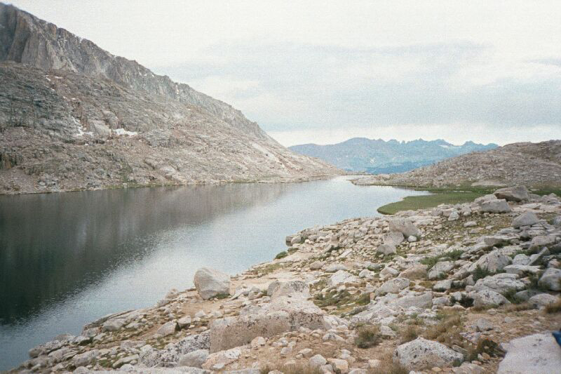
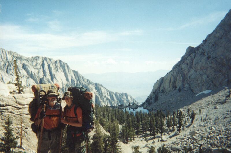
After packing we saddled up and pushed off for the intersection of the Pacific Crest Trail (PCT). We were at 11,400 ft and after a simple climb of 100 ft it was going to be all downhill to our destination, Rock Creek Ranger Station. The hike was to be 6 miles long and 2,000 ft loss of elevation.

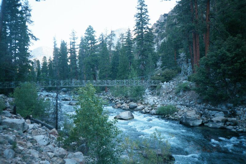
One mile into the hike we connected with the Pacific Coast Trail. We stopped to take pictures and pushed on down the trail. We remarked about the differences in the trail that we followed up to this junction and the PCT. It was obvious that this trail, although pristine, was used more by hikers coming from Cottonwood Lakes. We also would come to the realization that from now till the end of the trip, we would no longer be alone on the trail.
Our first encounter came about one mile later when we passed a couple of gentlemen that were hiking back to Cottonwood Lakes. They informed us that they had been at Rock Creek for a month and it was time for them to leave. They gave us valuable information such as the names of all the Rangers that we were going to meet. They also informed us that we were to expect rain in approximately a day and a half. This forecast was to prove to be true. But for now it was clear blue skies and a downhill walk to camp.

We arrive 4 hours later after leaving Siberian Pass. We were the first in camp so we took the opportunity to take a bath and clean our clothes. Rock Creek is a beautiful wooded spot with few mosquitoes. The elevation loss gave us renewed energy and soon we were playing in camp. Timmy was so energized that he made use of himself by gathering large logs. He then proceeded to lift and throw the logs for distance. I sat amazed at the difference between now and three days ago when he was struggling to get asleep at Tunnel Meadows.
Later in the afternoon we were joined by two Swedish hikers who were going the same way that we were. They had entered the wilderness at Cottonwood Lakes and were going to exit from Whitney Portal. They were going to be our hiking companions for the next couple of days. We were amazed at the equipment that the two of them were carrying. All new and completely over equipped. We estimated the Swedish mans pack to be over 100 lbs. He was tough and later we were to find out the he was a member of the Swedish Army and he was used to this kind of conditioning. Both individuals were extremely friendly and decided to hike with us the next day over Guyot Pass to Crabtree Meadows.
Later in the day were joined by yet another group coming from Cottonwood Creek. This was a family that was going up the PCT to Onion Valley. There they would leave their son on the trail so that he could hike the entire 214 miles of the John Muir Trail alone. This young man was an Eagle Scout and started hiking the Sierras with his troop when he was younger.
Rock Creek is an excellent stop over point. There was plenty of flowing water and a great campsite. However, on both sides are great climbs. It is a 2,000 ft climb in either direction to leave this secluded spot. We were to continue down the trail tomorrow going over Guyot Pass and across to Crabtree Meadows. We planned to leave before 7:00 AM and try to get to the Crabtree Ranger Station fairly early. We needed all the rest we could get to help us on our way. We went to bed early with deer in the meadow and with the sounds of a creek to lull us to sleep.
Day 9 - Monday July 2, 2001 ~ Rock Creek to Crabtree Ranger Station

We all woke at 5:30 AM. We had decided that we were going to hit the trail at 6:30 AM to try and beat the heat. We also decided to eat breakfast on the trail so that we would have energy during the last part of the morning’s hike. The initial part of the hike was to be steep gaining 1,500 ft in 2½ miles. Then we would cross Guyot Pass for a fairly flat walk to the lower Crabtree Meadows. Finally after lunch we would hike to the upper part of Crabtree Meadows where a Ranger Station and fresh water would welcome us.
The climb was uneventful and fairly easy. We must be getting acclimated to the elevation and also getting in better physical condition. We ate breakfast at Guyot Creek about ¾ of the way up the pass. We stopped at the summit only to have our Swedish friends join us. We had left them at camp while they were still in bed. It became clear that this Swedish Army soldier was in excellent condition and was ready for today’s hike.

The next 5 miles were to travel through fairly flat countryside. We needed to make it around Mt. Chamberlain and up Whitney Creek to the Crabtree Ranger Station. The elevation was now 11,400 ft and we were again feeling the effects of altitude. We made it to lower Crabtree around noon and the decision was made to stop for lunch. This is a beautiful meadow that had a stream running right through the middle that was full of golden trout. As we were eating lunch, we watched the trout catch bugs and such as they fell into the water. But the Ranger Station and camp was yet another 1.4 miles up the trail so we had to move on.

We made this climb in short order. We arrived and checked in with the Ranger, Erica. Erica is a young and beautiful woman and the three of us had conversations as to why such a young person would elect to spend their entire summer in such a remote place. We decided that it must be for the love of the wilderness and also decided that maybe all three of us would long to do the same thing as Erica. Erica showed us were the spring was located for water and also gave us permission to have a fire. This was a gift so that we did not have to fight with the stove. Erica also assigned us our needed conservation projects which was to clear the fire rings and to break down walls at our next stop, Guitar Lake. She also informed us to the fact that storms were expected for the next few days and to take cover during lightning strikes. This was good information. We immediately set up the shelter then it began to rain.
Rain in the Sierras is a blessed event. It gave us time to stay in the shelter and get needed rest. However, with rain comes lightning. Lightning in the Sierras is an awesome experience. Not so much the lightning as the thunder that follows. In this land of granite walls the thunder bounces back and forth with such extreme power as to make the three of us duck for cover every time we would see the flash of lightning. I cannot explain the power and the noise that would shake your physical and mental being every time there was a lightning strike. The enormity and grandeur must be experienced to understand. These storms were to stay with us for the rest of the trip making our lives pretty tough at best.
Crabtree Meadow is at the junction of the John Muir Trail and the Pacific Coast Trail. We were to leave the PCT for the John Muir Trail here and begin our direct route to Mt. Whitney. While we were in camp the Swedes came and left even through the storm. Later two Japanese fellows came into camp. They were coming down from Onion Valley and it was obvious that they were "spent" and wanted out. I spoke with them and they admitted that they took on more than they could handle. They wanted out and offered to leave us some additional food so they could lighten their load. I gladly accepted, and surprised the two boys with the newfound food. We feasted that night to Miso soup and pineapple cake.
Our final visitors at this grand spot were the family that was going to send their son off on the John Muir Trail. They had hiked all day through the storm and were a bit melancholy. They had changed their plans due to the daughters blisters and the inclement weather. The whole family had made the decision to exit at Whitney Portal and would portage the son to Reds Lake where he would be able to complete the hike to Yosemite. It looked as though this group would be sharing the trail with us till the end of the trip.
While in camp we visited and talked about hiking, food and bears. They found out that we were short of film and gave us one of the new disposable cameras. I found that they were carrying one of the heavy bear tubes. These are required in this area of the Sierras due to the heavy population of nuisance bears. We had taken a new form of safety by packing three of the new Kevlar Bear Sacks. These weighed less than a pound where the Bear Tube weighed close to six. I offered to leave the sacks with the family for the sons trip from Reds Lake. The area is known for its problem bears and the chance to save weight was greatly appreciated. We decided to meet at the end of the trail and I would give them the sacks which they would return at a later date. We also agreed to supplement their medical supplies for they were light on foot protection.
During the discussion we decided to go up the trail in the morning to set up a base camp at Guitar Lake to prepare for the climb up the hill to the summit of Mt. Whitney. That night we had an excellent fire, which was approved by the ranger, good food and a great sleep.
Day 10 - Tuesday July 3, 2001 ~ Crabtree Ranger Station to Guitar Lake

The next morning came fast. The weather was still threatening rain and sleet but we needed to continue on to the base of the final climb up to Mt. Whitney. We planned on stopping for the afternoon at Guitar Lake to perform an assigned service project. Ranger Erica asked us to break down some stonewalls that previous backpackers had made on the upper end of Guitar Lake. She also asked us to clear the Crabtree campfire rings of all tin foil. It seems that today’s high tech dehydrated foods are mostly packed in foil containers. A lot of backpackers have taken to a bad habit of burning the foil wrappers in the campfire rings. This action serves no purpose but to burn the plastic coating off the foil container but the foil is left in the fire ring. A courteous hiker should stir the ashes looking for this foil when breaking camp and pack the foil out. But it seems that "out of sight out of mind" rules prevail. We ended up with over a pound of foil taken from the fire rings at Crabtree.
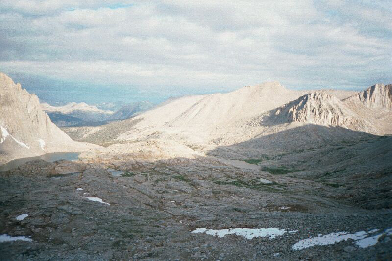
After talking and showing Ranger Erica our "booty" of trash we set out for Guitar Lake. The hike was to take us over the 12,000 ft level for the first time during the trip. We climbed about 3½ miles experiencing an arduous incline. We passed beautiful meadows and a couple of beautiful lakes. When we arrived a Guitar Lake there were no trees. We were above timberline and there would be no fires.
What desolate country. It had lightly rained all morning and we were a bit worried of the resumption of lightning. The beauty of the lake is unsurpassed. It indeed was shaped like a large acoustic guitar. This alpine country was home to numerous marmots that had no fear of humans. We were the only people at the lake probably due to the fact that tomorrow is the fourth of July. A holiday that is usually spent at picnics close to home, not on top of a mountain in the sleet and rain.
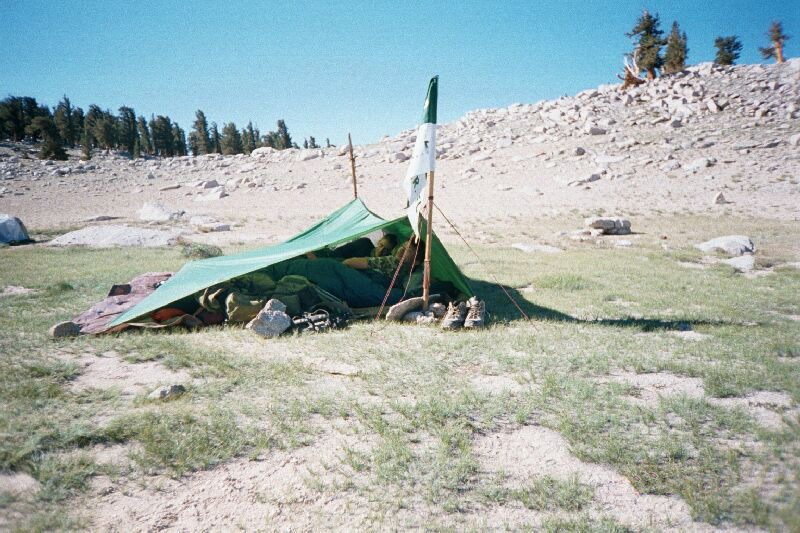
We continued to the upper lake till we had found the walls that the Ranger wanted us to dismantle. However a storm was bearing down on us at full speed so we set up the low shelter we had been practicing to set up for many previous training trips. We used the walls to break the wind and to keep the snow and hail from coming underneath the tarp. We barely finished the construction of the shelter when the full force of the storm hit. We had gale force winds for the next few hours that forced us to seek shelter in our low cover. The lightning had returned and the worries came concerning tomorrow's ridge climb to the summit. We took a long needed nap during the storm and woke to the white snowy country.
This is truly a country of extremes. As fast as the storm set in it left us. We woke and mustered out of the shelter very slowly. The sky was blue with the exception of the dark ring of storm clouds that stayed on the peak. Lightning was still striking the ridgelines above us that did not calm our worries about tomorrow. The afternoon and evening were beautiful. We were at the base of Mt. Whitney and the meadow and lake were pristine. The marmots were out in force and we played with them the rest of the afternoon.
Late in the evening the family that we had been traveling with came into camp. They had again started late in the day and had experienced the storm while on the trail. They informed us that they would be leaving at 4:00 AM to begin the push to the summit. The climb was going to be a tough 3,000 ft climb in 2½ miles at high altitudes. They stated that they were going to try to beat the morning storms by leaving early. After an evening meeting we decided to try and set off around 5:30 AM. The climb was before us and we also were worried about the storms. Late in the evening the rain started again and kept us hunkered down all night and into the morning. It was going to be tough going tomorrow. Worry kept me awake most all night probably due to the lengthy nap I had during the afternoon.
Day 11 - Wednesday July 4, 2001 ~ Guitar Lake to Outpost Camp
The Fourth of July was now upon us. I woke the kids at 4:30 AM when the family had passed making their way to the top of the mountain. The rain had stopped and we packed fast. We decided to hold off breakfast till halfway up the trail. However, when we were about ready to hit the trail another vicious storm hit bringing more rain and hail. We immediately grabbed the ground cloth and covered our packs to keep them dry. We ourselves then climbed under the plastic in which we road out the storm for about an hour. We sat there under the plastic with our back to a big rock talking about the trip. It is amazing that the most miserable times is when the closeness of family and friends are at it greatest. At this point in time I found that all the time and effort spent raising these two fine young men, Timmy, by his Dad and Mom, and Daniel by Myself and his Mom have paid off. These two young men I now know I can trust with my life and all my concerns faded away and I know that I am in good hands.
The rain finally subsided around 6:30 AM and we got on the trail. The climb was going to be difficult for me today and I knew that both the young men wanted to get to the top. They decided to ascend ahead of me and when the reached the top they would come down to help if needed. Daniel and Timmy made the first set of switchbacks in short order. I struggled from the lack of oxygen and general wear and tear from the previous 85 miles on the trail. I met up with them when they were having breakfast and I continued on. When they finished they also continued and passed me a short distance up the trail.
The next section of trail was a set of constant switchbacks. The entire trip to Trail Crest was entirely visible and even thought the kids were well ahead of me, we were able to communicate up the switchbacks with one another. Both Timmy and Daniel had a newborn energy level and were pushing up the hill with relative ease. For me, it was a very tough climb. Daniel and Timmy hit the Trail Crest intersection first and prepared a spot to store the packs. We were going to continue the climb up a spur to the Summit of Whitney without our packs. The packs were going to be covered due to the threat of rain and we would pick them up later that afternoon. After they had done so, they yelled down the hill that I was coming up to see if I needed help. My ego would not let me give them the OK to come down to help, and I think that they understood so they waited 30 to 40 minutes till I came up to the Trail Crest Intersection. I rested a short period of time and then we set off for the 2 mile walk to the Summit of Whitney.
A little background of the trail that we had just intersected. This is the trail that comes up from Whitney Portal that ultimately end up on the Highest point in the contiguous United States. This trail is by permit only and only 100 hikers are allowed to used the trail a day. We also needed a permit to descend down this trail coming from the backcountry. We had gone trough the most pristine country in the Southern Sierras only to be assaulted by an army of misbehaved day hikers. All along the trail there was trash and toilet paper. The hikers were all ill-equipped for the threatening storm. They were all partying, cutting the trail and other misguided actions. We had a discussion about this and decided that we would do our best to carry out as much trash as we possibly could. We would add it to the trash collected at Crabtree and deliver it to the Ranger Station in Lone Pine. It is sad to see what is happening to Mt. Whitney, but we could only do our best to make things a little better. By the end of the next 11 miles we were to collect 20 lbs of trash including a frying pan and some sneakers.

Daniel and Timmy set off first for the summit. They sped along the trail no longer hindered by the weight of their packs. I lagged behind again looking for my energy and not quite being able to find the reserves that I needed to make this 2 mile hike at 13,500 ft. The trail followed the spine of the Sierras that at times had sheer drops of 2,000 to 3,000 ft. This trek along this ridge was too beautiful for words. We could see all the way back 75 miles from where we came. We could see Forester Peak to the north and the town of Lone Pine directly below us to the east. We also could see both the North Fork and the Main Kern River drainages to the west. But alas time was running low. There was a storm setting in from below and making its way up the eastern front of the Sierras. We needed to get to the top soon if we were to be successful. It was not the cold and wet that worried us, it was the constant lightning that was striking the peaks to the South. It would soon be on us and we needed to be off this barren spine at the top of the world.
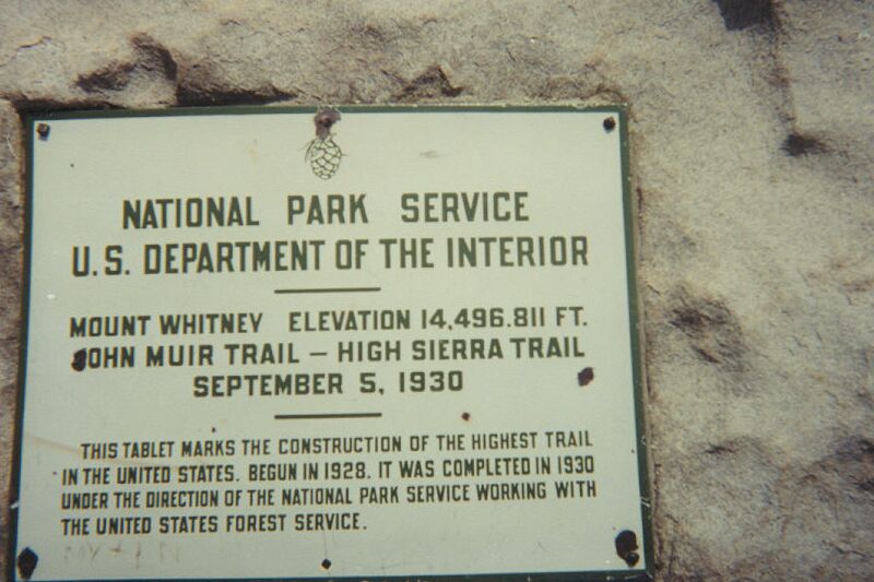
There are signs at points along this location that warn one of sudden storms and the threat of lightning. It was beginning to hail during the final 1,500 ft climb to the top but I finally made it to the top where the boys were waiting. There is a book at the stone building on top of Mt. Whitney that one can sign and I placed a single comment in the ledger "I did it for Daniel". God made this trip for us and this said it all.
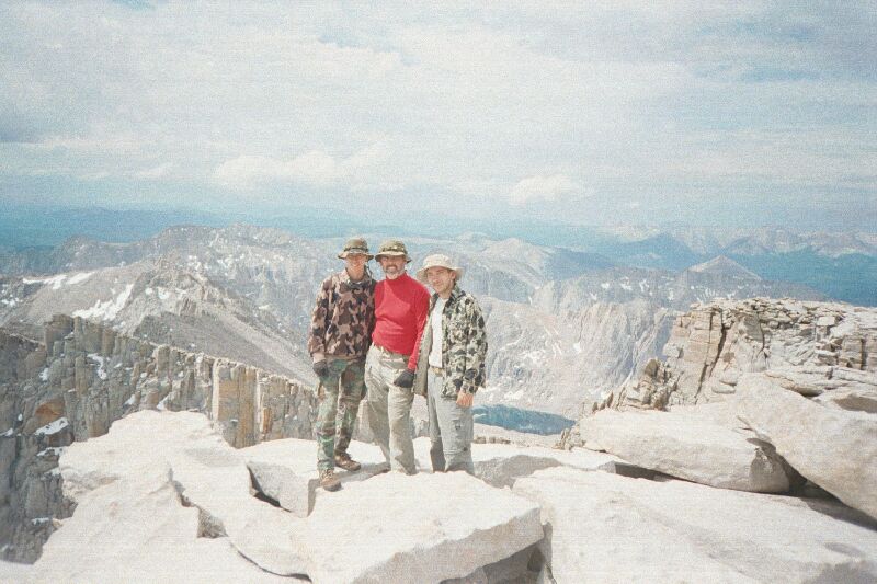
Once upon the peak, the sky opened up and gave us sun and blue skies. This must have been God's gift of a job well done. We were able to get some pictures and stay about an hour basking in the sun on the warm rocks. We congratulated each other and watched as some of the day hikers were making their way to the summit to make cell phone calls home. If they only new what was on the other side of the mountain, the side in which we came. I guess that it is good that they do not know, or have the ability so that the true wilderness is not so mistreated.
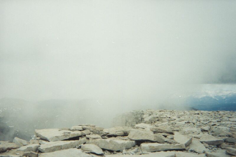
After an hour, the black clouds began to threaten. The rain clouds from below were beginning to push up the face of Whitney directly below and the wind was bringing a mist up and directly over us. It was eerie to experience this fog beginning to close in around us. Time was running short. We needed to leave before the storm set in. We hugged each other, told each other how much we meant to one another and how we loved the outdoors. But, it was time to go.
Shortly after leaving the summit, a hails storm set in and it blanketed the ground with white ice pellets. It was going to be a cold, wet hike down the trail. About two thirds of the way down the trail lightning began to strike the distant ridges. Daniel and Timmy made the decision to "hunker" down for safety. They took the tarp and covered the packs then each of us crawled under the tarp and leaned against our packs. It was a good decision as the rain began in earnest. We all became comfortable and slowly began to fall asleep.
About a half and hour went by when other hikers came by. They were a bit scared, as the lightning was quite close. We invited them under our make shift shelter which they gladly accepted. We were a bit embarrassed with our condition. It must have smelled like a bear cave under the tarp but the young ladies and gentlemen did not let on any disgust. We were very apologetic and they were quiet courteous. They were just very glad to be out of the elements and I think that they were also glad to be with some "trail wise" people to help make them safe from the storm.
After another hour, the storm cleared and we said good-bye to our companions. We saddled up for the long downhill, which will eventually end up at Whitney Portal. This part of the trail is very inhabited with day hikers and single overnighters. Everyone that we passed made comments like "WOW where have you guys been?" Either they thought that they were going to look like us when they came down or maybe they just wanted our story. We probably passed no less than 150 people on the way down the mountain. Most of the people it was obvious had just come from REI with their new bright and shiny gear.
It was disappointing through this part of the trail. From Trail Crest to Outpost Camp garbage was everywhere. We had picked up all the garbage along 80 miles of backcountry trails and removed all tin foil from fire rings and it all fit into one, two-quart plastic bag. Now we were exposed to this ungodly sight. Picking up all the garbage is to big of a task for three tired backpackers. Our hearts ached about the destruction of the Whitney route. People need to see the backcountry to understand how pristine the Sierras should be. If they did, maybe there would be more respect.
The descent down from trail crest is very steep and in places dangerous. There was snow still on the trail that made footing difficult. There was one section of trail that has a cable on the downhill side. There was ice on the trail, and a slip would mean at least a 1,000 ft fall. If it weren't for the cable, this part of the trail would have been impassable.
Daniel and Timmy made great time going down this part of the trail. They bottomed out just before Trail Camp and waited till I arrived. We had a short discussion about safety and how it was bad to leave one behind in such a dangerous area. So, after I got that off my chest, all was right with the world again and we decided to push on.
When we came to Trail Camp, there were about twenty groups of people set up to overnight at this spot. This is only one of two spots that one is allowed to spend the night while on this trail. Again, everyone wanted to know where we came from and why we decide to come the long way. It was fun to talk, we decided it must have been my 12-day beard that made us look like children of the mountains.
We decided to continue down the trail to Outpost Camp. There were too many people here and the stench of the solar toilets was to much to bear. The trail leveled out for a bit and then proceeded to go down at a much lesser grade than the previous 5 miles. No longer would we have the danger of falling off the edge should our footing fail. We made our way to Outpost Camp at a slower rate. We put in about 15 miles this day at the highest point of the trip. By the time we get to Outpost Camp, we were exhausted.
Outpost Camp is a very Beautiful place. We were back into the timber and a creek runs directly through camp. When we arrived, a Ranger met us to check our permits. This was the first time we were asked to find our permits during the entire trip. After checking we were given the "go ahead". The Ranger went back to picking up trash and we offered to carry the bags out with us to be disposed of. The Ranger gladly accepted and appreciated that we would carry these bags out the last four miles.
We made a fine dinner and Daniel broke out the light sticks for our 4th of July Celebration. Fatigue set in and shortly after dark we were fast asleep.
Day 12 - Thursday July 5, 2001 ~ Outpost Camp to Whitney Portal
Woke at 4:45 AM and started to pack. There was no remorse today as in the past about leaving the wilderness which in turn leads me back to my normal life. I think that this is due to us having hit our limit. We are all ready for a shower and back to real food.
I cooked for the last time, eggs this morning with the leftovers from the trip. I fed the boys in bed and gave them the chance to warm in the sun for a short period of time. This was the first time on the trip that we were able to experience the early morning sunrise as most of the trip the eastern skyline was blocked by 10,000 ft peaks. We all had a bit of the smell of the barn and I knew it would be a fast walk out.
Again, we passed numerous hikers making their way up the trail. All dressed in the bright REI colors. Everyone that passed stopped us to ask us where we have been and to ask advice. We were seasoned hikers that it seemed the others looked up to including the young men. It was their time to be the advisors. We had a new found confidence, and people understood that we knew what we were doing. This attribute has been developed over many miles on the trail under the guidance and teachings of Boy Scout Troop 505 in Tracy California.
Nine years of intense High Adventure training gave us the knowledge and confidence that emitted from ourselves on this the final day of the trip. People could see and sense the fact that these three individuals were trail wise and were trained well. The hikers going up the mountain with $1,000.00 of equipment, clothing, packs and boots. We just finished an arduous 12 days and 100 miles with less than $200.00 worth of equipment, food and clothes. Our packs have many miles on them. They may not look as bright and shiny, but they fit us well and can carry everything that we needed during this venture.

We finally made the parking lot at 11:00 AM. There were many eyes on the "grungy" three that just came off the trail. We laid our packs outside the store and went inside to inquire about a shower that we could uses. In a short time we made all the necessary arrangements and we took our hot showers in turn. However, it would be days till we would be completely clean and free of trail dust.
Mrs. A showed at about noon with the car to pick us up. We loaded and settled into the first comfortable seat in 13 days. We spent the night in Stockton and said out good-byes to Timmy.
Day 13 - Friday July 6, 2001
The story does not end here. We had one final journey to make to complete this long sojourn. We must make the pilgrimage to the top of the world to pay homage to those who came before and to God for making this a safe and delightful trip. The Top of the World is in Tuolumne County which is 250 miles away. It is the final stopping point for the Troop 505 50 milers. I have pictures with me and my sons over the past 7 years at the same spot and I must get a picture again this year. We will also be proud to take mom on the 8-mile hike for the first time in as many years.
We drove to Bummers Flat and proceeded down the trail towards Horse Meadow. Daniel led mom down the trail and we took a quick stop at Horse Meadow. The mosquitoes were out in force so we continued down the trail to the Top of the World.
When we arrive it was here that the many miles of trail and exhaustion of many days made the emotions run high. This is a very special spot for the Arnolds and Troop 505. While not quite the Top of the World, the view is one of the Dardanelle Cones and back east across the landscape of many training trips. Tears came to all eyes as have had during many past trips to this very spot. Now it was Mom’s turn to understand the importance and spiritualism of this very spot. I have spoke with God many times over the past trip but it is at this place that I feel the closest to Him. This is indeed a very special place.

We spent a couple of hours here and took many pictures. But it was time to go. We had to hike out and drive 400 miles today to get near the airport that would lead us back to Florida and home. Weather was setting in and we had one final stop to make at Horse Meadow.
The trail back to Horse Meadow was in good shape but many mosquitoes were present. The latest rains have brought the little devils out in force so we proceeded at a high rate. When we arrive it was sad to see that the old bear tree had fallen but nothing else had changed. Daniel showed mom around and gave her some of the memories that he had of this special spot. This is the place that the final campfire is always held from the Troop 505 50 milers. Daniel found a gift in the tree by the fire ring that was left by the troop a few weeks before especially for him and me. It was a gift of two fine ornamental eagle feathers which signify an extraordinary task well done. The troop left them for praise of the 100-mile backpack trip. There is always much pride when Mr. Gilliam as well as the rest of Troop 505 recognizes an effort. Daniel now has his second Eagle feather and me my third.
The final visit was to the miners stash located in the rocks by the spring. This was where we would get our final fill of the canteens before the long push back out the trail from which we came. We left with sadness and progressed up to Eagle Nest then out to Bummers Flat. Upon reaching the car, the trip was finally complete. Over 100 miles of hiking and we were now to return. No emotions this time at Bummers. All thoughts were on the long journey down to Orange County to catch a plane tomorrow to return to Florida.
There is nothing more to be said with the exception of having two weeks to get closer to one another and God. God gave us an excellent trip to renew our family bonds.
Acknowledgements
There are many people to thank for this trip of a lifetime.
Firstly thanks to God by making this trip difficult but not miserable. Also thanks to him for creating the wilderness and granting us the knowledge to be able to partake in its wonders. Take a look at the sky in the middle of the night in the Sierras and you will understand God’s wonder and might.
Secondly to Daniel for making this commitment to spend a few tough weeks with his dad making sure that I was OK and urging me along the trail.
Thirdly to Mom for letting me pursue my strange need to be by myself and to push myself to the limit. Michael got me involved with this strange endeavor, and Mom puts up with my eccentric need to do something like this every year. The worries are obvious, but letting me continue till I can do no more is a gift that cannot be repaid.
Fourthly to Timmy, his companionship and focus on helping Daniel during slow times is greatly appreciated. Your Dad and Mom raised you well and I am proud that you let me be a part of your life.
And Lastly to Michael, who is always in my mind and heart. He was the one that got me into this strange hobby, and I wish that he were with me all the time while I was on the trail. Michael is always a calming influence upon myself and when my temper gets short, or when I am in a stressful environment, it is Michael that always centers me. He was my constant mental companion on this trip.
Also acknowledgments to the Scoutmasters of Troop 505
To Mr. "G"Without you I would not know my children. I am sure that other more pressing issues would pull my attention from Michael and Daniel if it weren't for you focusing my attention on what is most important. I cannot say enough to give you ample credit for the success of my family. Thank You Gerry
For teaching me the ways of the trail. You have always been with me taking up the rear the whole time my friend. You have taught me the skills of organization and patience. Ces
For teaching me the "extras" that I would need to make life more comfortable on the trail. Also for pushing me in the early years to have fun and to enjoy a bit of competition Glenn
For giving me strength and fortitude and by teaching me how to make decisions in times of unclarity. Ron H
For teaching me the need for technology in the field. We would have had a much more difficult time without the GPS and other gadgets that we brought along. Brad C
For his love of nature. We stuck our noses in many Jeffrey Pines along the way. Ray
For getting through to us the need for wilderness survival skills. We survived only by his training through 4 tough days of rain and hail. Ralphie
For being a "brother" to me And finally to all the scouts of Troop 505 for letting us Scoutmasters pass on our knowledge by teaching all of you the ways of the trail.